|
| Adam Pigg | |
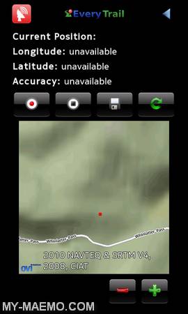 | Pgz-Everytrail   Free   Â
Qt interface for everytrail.com. EveryTrail.com is the best way to share trips, connect with other travelers and find great new things to do
With this application you can create... |
|
|
|
| Alberto Mardegan, Dennis Nienhueser | |
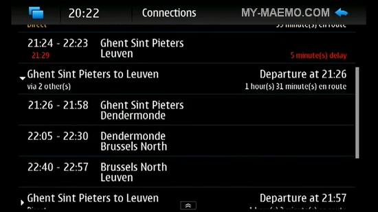
 | MoNav Routing Daemon   Free        1 comments     1 comments
Routing server for other applications.
The MoNav Routing Daemon (MoNavD) is a service that computes routes on OpenStreetMap data. It provides exact routing without heuristic ass... |
|
|
|
| Alvaro Manera | |
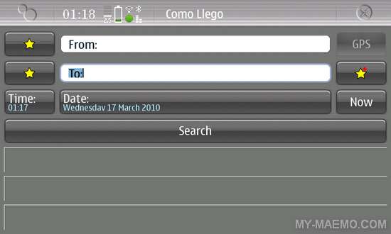 | Como LLego   Free   Â
Helsinki Journey Planner - plan your public transportation trips in Helsinki with this nice tool.
... |
|
|
|
| Amir Bendjazia | |
|
|
| André Xuereb | |
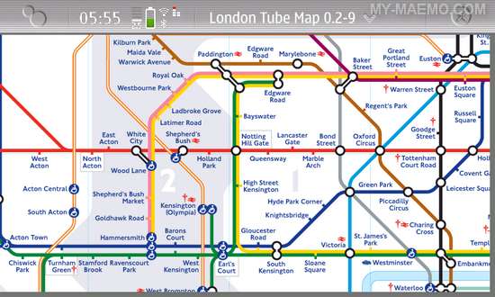
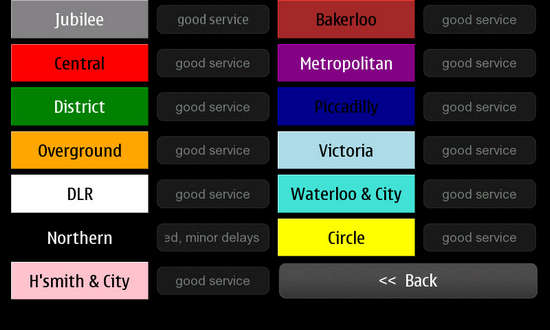
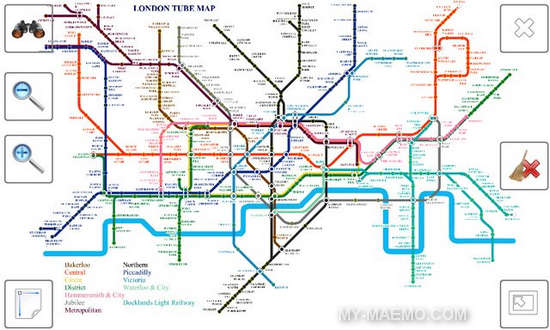
 | Tubes   Free       1 comments
A simple offline router for the London Underground system.
... |
|
|
|
| Andrej Krutak | |
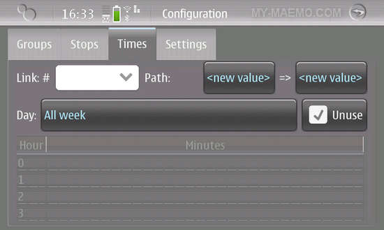 | PTSS   Free   Â
Public Transport Service Schedules.
This app is able to group connections and show all departure times at once. You can provide time schedules for several connections from sever... |
|
|
|
| Andrew Flegg | |
 | Here And Now   Free        2 comments     2 comments
Find what's going on around you.
"Here and Now" is a Nokia service, bundled as part of Symbian^3. Using the information on the mobile phone towers your phone is attached to, inf... |
|
|
|
| Andrew G | |
| OM Voice Server   Free        3 comments     3 comments
OMVoiceServer is a voice server for Ovi Maps on the Nokia N900 to allow spoken directions as well as enable future features and functionality.
For more details, please see this ... |
|
|
|
| Axel Pauli | |
 | Cumulus   Free        1 comments     1 comments
Cumulus is a flight computer for glider pilots.
Cumulus features a full colored moving map display with elevations, airspace, terrain and airfields information. It can use waypo... |
|
|
|
| Bartlomiej Ceglik | |
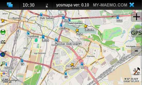 | Yosmapa   Free        1 comments     1 comments
Plugin oriented navigation application based on Open Street Map.
Yosmapa features:
Strong plugin oriented system
plugin - get link to my location for Google Maps
plugin... |
|
|
|
| Bastian Holst | |
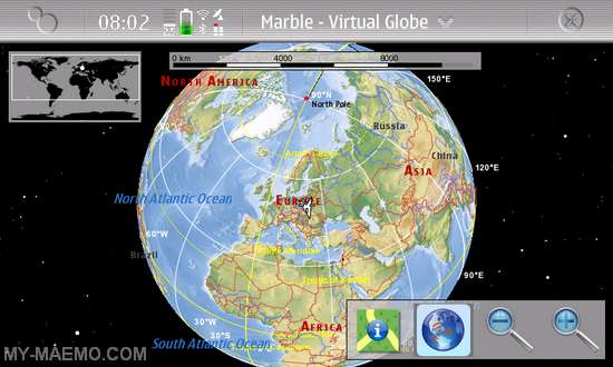 | Marble   Free       5 comments
Marble is a Virtual Globe and World Atlas that you can use to learn more about Earth: You can pan and zoom around and you can look up places and roads. A mouse click on a place lab... |
|
|
|
| Christoph Eckert | |
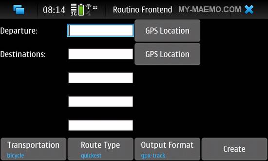 | Routino Frontend   Free   Â
GUI frontend for Routino providing easier and quicker use, without having to deal with the command line.
Routino is an application for finding a route between two points using ... |
|
|
|
| Christos Saturn | |
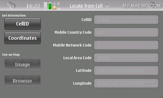 | Snuggle   Free        3 comments     3 comments
The Locate From Cell (aka Snuggle) application uses the cell tower information to locate your location coordinates.
The application makes use of the CellID parameters and Google... |
|
|
|
| Cintrus | |
 | Facemap   Free      Â
Use your social network to see people around you. Find new friends on the map!
It's all about map and faces. Well, the idea is pretty simple. Just login with your social account... |
|
|
|
| Corentin Chary | |
 | Lugdulov   Free       1 comments
A bike sharing application.
Find availables bikes on bike sharing systems. It's like A Bike Now (on iPhone) or Cycloid (Android).
You can search for bikes and stations ... |
|
|
|
| Damian Waradzyn | |
 | CloudGPS   Free       5 comments
Simple yet the smoothest tile mapping application for the N900. Now with partial 3D and accelerometer support.
It is a complete rewrite of J2ME version to N900 using OpenGL ES f... |
|
|
|
| Daniel Fett | |
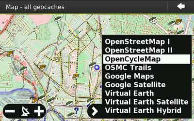
 | AdvancedCaching   Free       1 comments
Paperless (offline) geocaching.
AGTL downloads cache locations in the area visible on the map including their description, hints, difficulty levels and images. Searching for cac... |
|
|
|
| Danielle Madeley | |
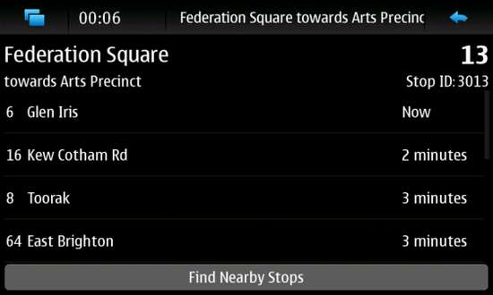 | Tramtracker   Free   Â
Real time tracking of trams in Melbourne, Australia.
... |
|
|
|
| David Hautbois | |
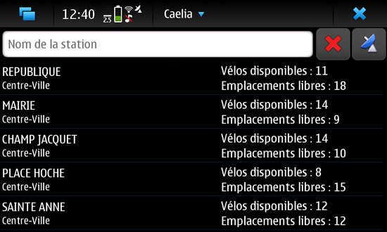 | Caelia   Free   Â
Caelia is a search application for the Rennes city self-service hire scheme.
... |
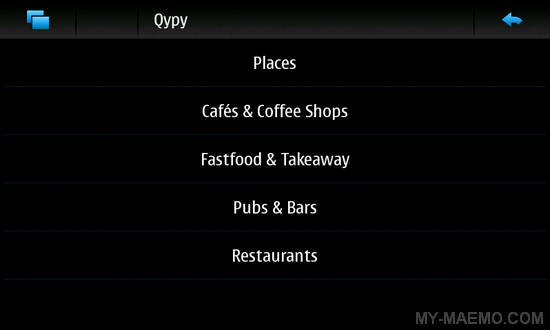 | Qypy   Free      Â
Qype service client, lets you search for proximity services. Qype provides reviews on many places like restaurant, bars, hotels.
... |
|
|
|
| Earthcomber | |
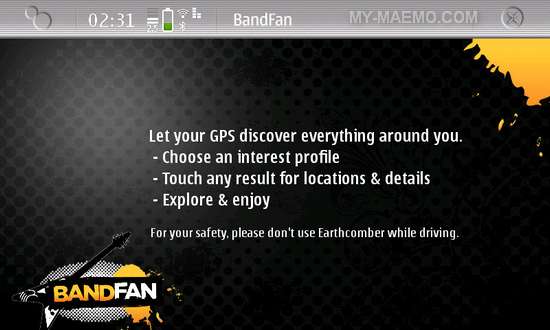 | BandFan   Free   Â
BandFan uses GPS and a live location network so you can find your favorite concerts. Find new bands or epic artists, from indie pub dates to ampitheater events. BandFan's screen is... |
|
|
|
| EasyPark | |
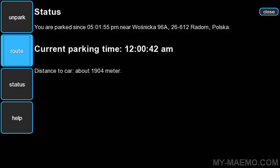 | EasyPark   Free   Â
EasyPark is a Web based app that helps you park your car and find it again. It will guide you back when you forgot where you parked it.
... |
|
|
|
| Extend Dev | |
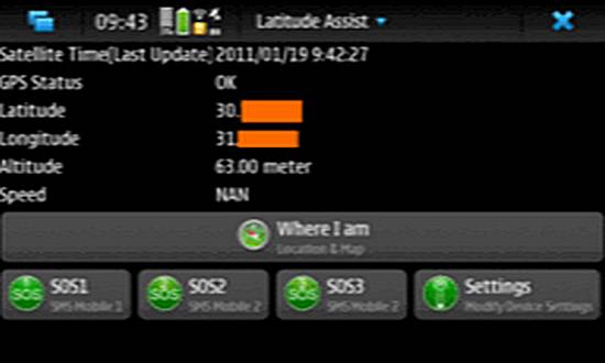 | Latitude Assist   Commercial       1 comments
Assistance to anyone who may be in an emergency situation: the application is to be used as SOS tool with up to 3 pre-configured mobile numbers. With this application, you can acce... |
|
|
|
| Fabrice Crohas | |
 | QLandkarte M   Free       1 comments
QLandkarte M is a raster maps GPS application using GeoTiff as input files.
This is a moving map application for mobile devices. As QLandcarte GT it will display mapsets of diff... |
|
|
|
| Felipe Crochik | |
 | Crochik GeePS   Free       14 comments
Front-end for Google maps optimized for the n900.
The application can be switched to full screen and supports satellite, road map and terrain views. It shows your current positi... |
|
|
|
| Gérald Fauvelle | |
|
|
| Girish Gopi | |
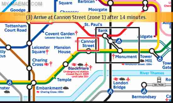
 | Tfl App - London Journey Planner   Free       5 comments
An applicaton to get you home via public transport in UK.
Works best inside London. Anywhere else in England, it redirects you to Google Transit (who's coverage is not great at ... |
|
|
|
| Henning Heinold | |
| maptool   Free   Â
Tool to convert OpenStreetMap maps to NavIt.... |
 | NavIt   Free       6 comments
NavIt is a car navigation system with routing engine.
Its modular design is capable of using vector maps of various formats for routing and rendering of the displayed map. It's ... |
|
|
|
| Henri Bergius | |
|
|
| Jari Multisilta | |
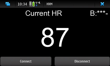 | HXM Tracker   Free       1 comments
Heart rate and location tracker for Zephyr HXM. You must have the Zephyr HXM BT belt for using this application.
... |
|
|
|
| Jean-Charles Lefebvre | |
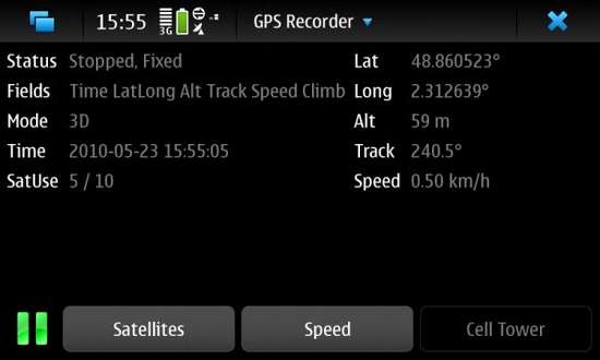 | GPS Recorder   Free       2 comments
GPS track logger to KML, GPX and/or CSV formats.
Yet another GPS track logger. Main features:
Gathers as much information as possible from the GPS subsystem at a desired... |
|
|
|
| Jesse Hakanen | |
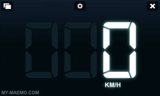 | JSpeed   Free       5 comments
Highly customizable speedometer application for Maemo 5.
... |
|
|
|
| Joey Chen | |
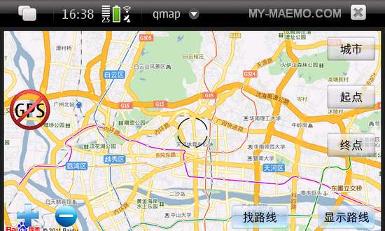 | AesyPig   Free    1 comments
AesyPig is a map application for Maemo and MeeGo, part of the QMap project.
... |
|
|
|
| John Costigan | |
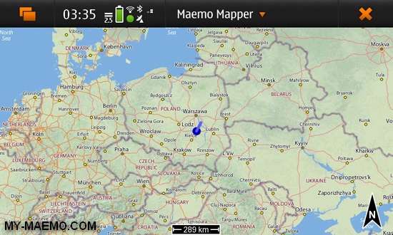 | Mappero (a.k.a Maemo Mapper)   Free       15 comments
Maemo Mapper a very capable geographical mapping tool that can be used to:
Download map data to your device's main memory or to an external memory card.
View that map data on t... |
|
|
|
| Jon Staley | |
 | gigfinder   Free   Â
Simple app that uses last.fm event feeds to find gigs nearby.
... |
|
|
|
| Jussi Laitinen | |
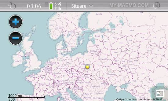 | Situare   Free       11 comments
Locate and share your position with friends.
Situare application introduces a concept of social locating. It allows users to view, update and share their location using Facebook... |
|
|
|
| Kaj-Michael Lang | |
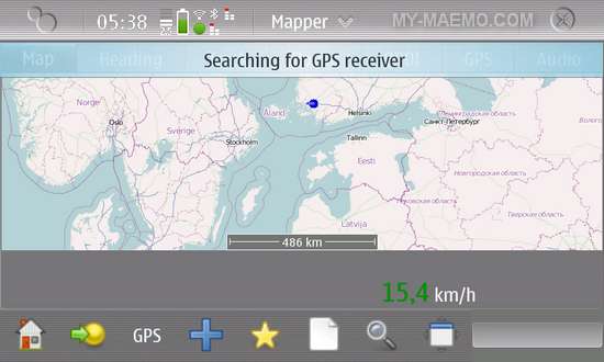 | Mapper   Free       1 comments
Mapper is tool for using and collecting geo data for map creation. You can collect tracks with support for audio for easy editing in JOSM. It can use OpenStreetMap data to show you... |
|
|
|
| Kilut Oy | |
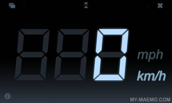
 | Speedometer Pro   Free      Â
Digital speedometer which shows your speed in km/h or mph. Speedometer also saves max and average speeds and allows you to save your tracks and export them in Google Earth KML-form... |
|
|
|
| Kinevia | |
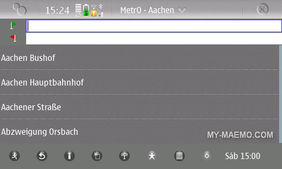 | Metro   Free       4 comments
Metro is your free guide on smartphone to public transport systems worldwide (400 cities covered now).
... |
|
|
|
| Laurent Bigonville | |
 | Azimuth   Free       1 comments
Azimuth is a small application publishing your location to your contacts.
Azimuth doesn't enable the GPS itself so you have to start another application using the GPS (like OVI ... |
|
|
|
| Leonid Gusak | |
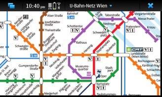
 | qMetro   Free       1 comments
Map of the transport system for many city subways.
Vector metro (subway) map for calculating route and getting information about transport nodes. Maps have an open format and ca... |
|
|
|
| Luciano Montanaro | |
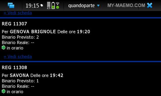 | Quando Parte   Free       2 comments
A program to check the Italian train station schedule.
This program is meant to quickly lookup the train departures and arrival times in train stations in the vicinity of the us... |
|
|
|
| Marcell Lengyel | |
 | GPS Track Logger Widget   Free       2 comments
A GPS tracklog saver desktop widget.
A widget for the Hildon desktop that can be used to collect and save a GPS tracking to a file for later use (e.g. photo geotagging, visualis... |
|
|
|
| Martin Kolman | |
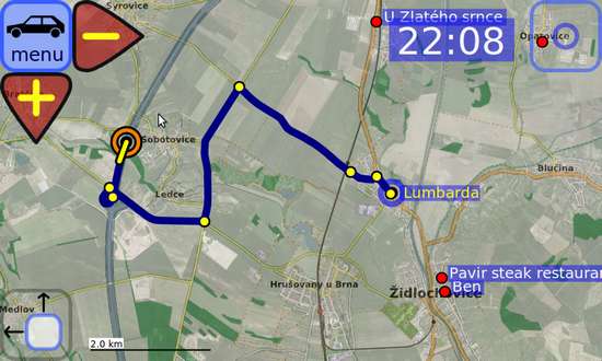 | Modrana   Free       24 comments
A flexible GPS navigation system.
WHAT DOES IT DO ?
Map display
-> from map tiles
-> semi-transparent layer-over-layer overlay is supported
Tile download
-> automati... |
|
|
|
| Matan Ziv-Av | |
|
|
| Max Waterman | |
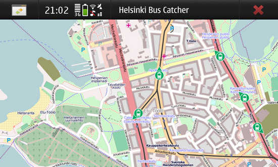
 | ZouBa   Free   Â
Tells you which bus is next in Helsinki area.
Allows you to easily find how to get the bus home. Uses HSL Journey Planner API. Uses GPS for current location. Uses Qt and QtMobil... |
|
|
|
| Mika Pelttari | |
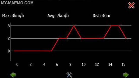
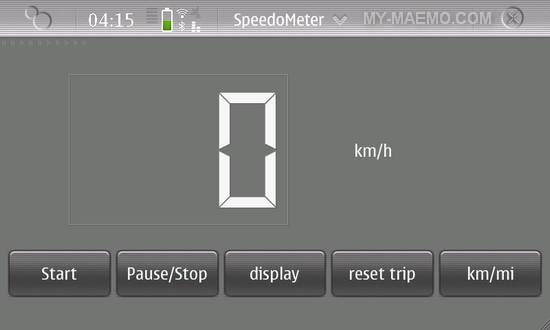 | Speedo   Free       1 comments
Speedometer with time and distance measurement. Uses N900's built-in GPS. Features total distance and trip time measurement with 1/10s accuracy.
... |
|
|
|
| Mikkel Munch Mortensen | |
 | Rejs-DK   Free   Â
Get public transport timetables from nearest Danish stations and bus stops using data from Rejseplanen.
... |
|
|
|
| Nano | |
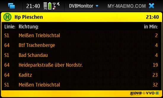 | DVBMonitor   Free       2 comments
DVBMonitor is a schedule for public transport in Dresden and Umland (Germany).
The program shows in how many minutes the next train or bus comes to the selected station. It als... |
|
|
|
| Nikita Nalyutin | |
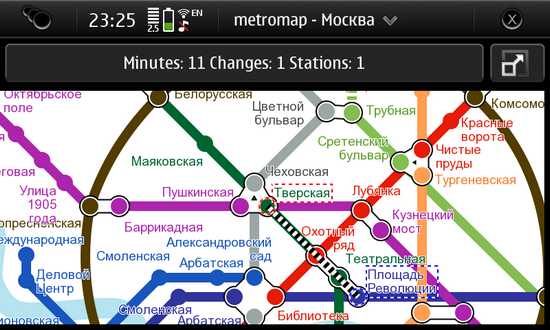 | MetroMap   Free       4 comments
MetroMap displays and calculates best routes in metro of different cities:
Moscow
St. Petersburg
Kiev
London
Berlin.
The program is based on PC version of MetroMap (h... |
|
|
|
| Offscreen | |
 | Speedometer   Free        2 comments     2 comments
Large clear to read speed-o-meter.
Digital display with a choice between km/h and mph.
... |
|
|
|
| Opax Amazigh | |
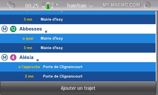
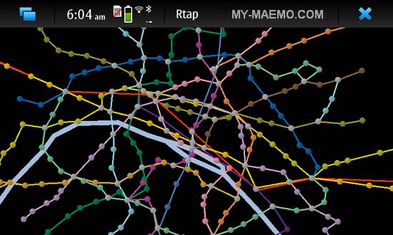 | Rtap   Free       1 comments
Mobile friendly routing through Metro/RER network in Paris. It's optimized for the N900 and fingers. Doubleclick to select a station. Double click on the "power button" to launch g... |
|
|
|
| Orava | |
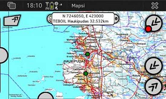 | Mapsi   Free       8 comments
Mapsi is a map application that uses maps from Paikkatietoikkuna.fi. That site offers Finland topographic maps and so Mapsi is only useful for people in Finland.
Features:... |
|
|
|
| Philipp Zabel | |
 | Beifahrer   Free       2 comments
Find lifts in Germany.
A frontend for the mitfahrgelegenheit.de / mitfahrclub.adac.de ride-sharing web service.
The point of departure can be determined automatically f... |
|
|
|
| Pierre-Luc Beaudoin | |
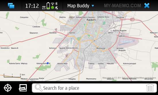 | Map Buddy   Free       1 comments
Navigate maps and search for local businesses. Map Buddy is an (OpenStreetMap) map viewer application to find your position and way that starts in less than 10 seconds.
... |
|
|
|
| Raed A | |
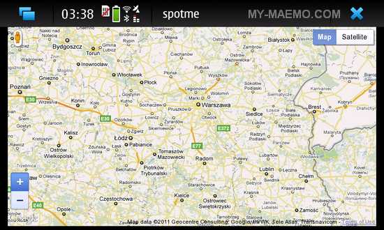 | SpotMe   Free        3 comments     3 comments
SpotMe displays your location on Google map.
This application uses Google Map API V3 to display your current position detected from N900's integrated GPS device. The application... |
|
|
|
| Rodrigo Linfati | |
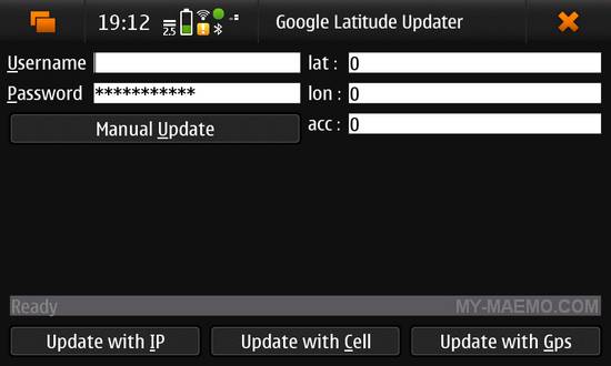 | Google Latitude and Buzz   Free       3 comments
Google Latitude and Buzz Client written in QT4.
Features:
Retrieve location using Cell Tower and send to Google Latitude
View Location of Friends
View Buzz of Friends
... |
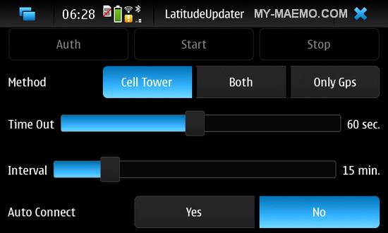 | LatitudeUpdater   Free        1 comments     1 comments
Google Latitude Updater written in Qt4.
Features:
Retrieve location using Cell Tower and/or Gps and send to Google Latitude
Run as Daemon.... |
|
|
|
| Roman Moravcik | |
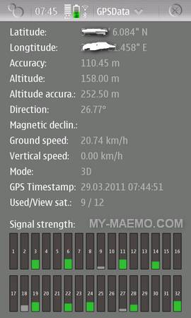 | GPSData   Free       3 comments
A simple GPS status application and compass.
GPSData is an application displaying extended GPS information (direction, ground and vertical speeds, magnetic variation, hor... |
|
|
|
| Sampo Savola | |
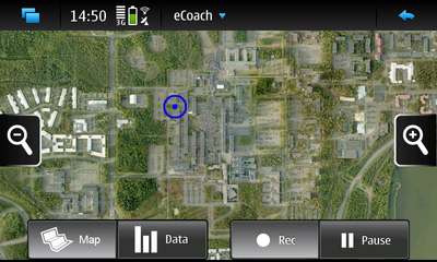 | eCoach   Free       4 comments
eCoach is an application for managing sport and exercise activities.
Keep track of all your sports and outdoor activities with the GPS-based eCoach application. With eCoach you ... |
|
|
|
| Simon Pickering | |
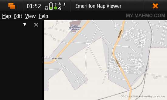 | Emerillon   Free   Â
Map viewer for the GNOME desktop.
Emerillon is an opensource map viewer which uses OpenStreetMap data in order to display browsable maps, allow searching for places and using pl... |
|
|
|
| Stewart Holmes | |
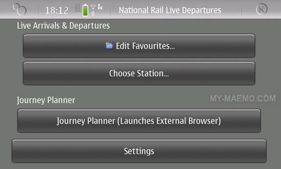 | UK Train Planner   Free       1 comments
An application to plan train journeys and provide live updates, using National Rail Enquiries' live updates.
... |
|
|
|
| Svenn-Arne Dragly | |
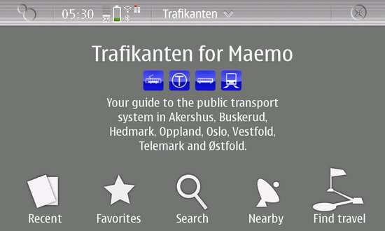 | Trafikanten   Free   Â
Journey planner for Norway provides public transport information from Trafikanten's information system.
The application gives you realtime information, travel search and nearest... |
|
|
|
| Sygic | |
 | Sygic Mobile Maps   Commercial       11 comments
Sygic Mobile Maps turns your Maemo smartphone into personal navigation device with spoken voice instructions and route guidance.
Features:
No hidden fees. With pre-instal... |
|
|
|
| Thibault Cohen | |
 | Mass-transit   Free   Â
Fetch all Montreal bus schedules with this application.
... |
|
|
|
| Thibaut Gridel | |
| Routino   Free   Â
Routino is a set of tools to find a path between two points.
Routino is an application for finding a route between two points using the dataset of topographical information coll... |
|
|
|
| Thomas Perl | |
|
|
| Thomas Schwery | |
 | BiciMobile   Free   Â
A Velopass / Bicincitta application.
This application provides a simple way of checking for available bikes in the Velopass (name given to Bicincitta in Switzerland) networks.
... |
|
|
|
| Thomas Thurman | |
 | Belltower   Free   Â
Belltower is an application for the Nokia N900 to find belltowers hung for English change ringing.
With Belltower, you may:
List all towers within fifty miles of you, us... |
|
|
|
| Thomas Waelti | |
 | maeMaps   Free       2 comments
While there is still no native, dedicated Google Maps application for the Maemo platform, you may try maeMaps, web based Google Maps "interface" with N900 optimized design. It allo... |
|
|
|
| Till Harbaum | |
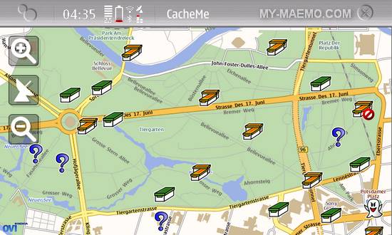 | CacheMe   Free       3 comments
Online geocaching application.
CacheMe is an online geocaching application using the latest Qt technologies like QtMobile.
... |
 | GPXView   Free       4 comments
Complete offline geocaching solution
The GPXView application reads and displays geocaching.com GPX files and serves as a geocaching navigation tool.
The main features o... |
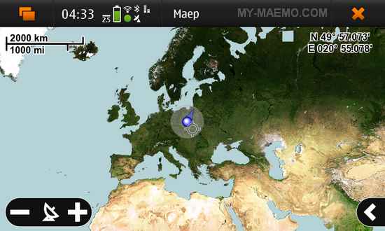 | Maep   Free       8 comments
Maep is a simple tile map utility showing you the current GPS position and letting you browse the maps. It uses the following map services:
OpenStreetMap I
OpenStreetMap II
Op... |
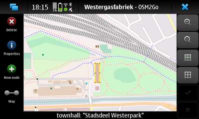 | OSM2Go   Free   Â
A mobile OpenStreetMap Editor
OSM2Go is a lightweight editor for OpenStreetMap intended for mobile devices and small screens.
This mapping tool is particularly suited for sma... |
|
|
|
| Tim Besard | |
 | BeTrains   Free   Â
Planning application for Belgian train voyagers.
BeTrains is a handy mobile application for the Belgian train users. It allows you to easily plan voyages, view liveboards, and m... |
|
|
|
| Tim Teulings | |
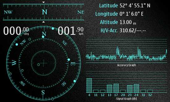
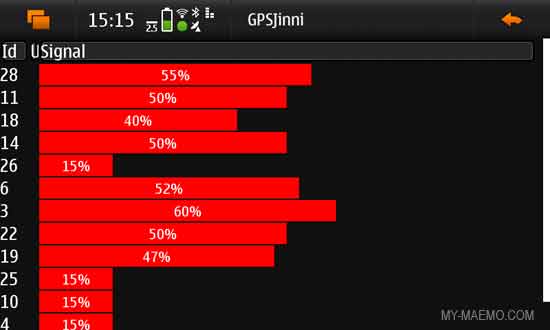 | GPSJinni   Free       7 comments
A simple appalication showing raw data from the GPS subsystem.
These include detailed location data, signal strength, compass, speed and altitude diagrams, and tracking.
... |
|
|
|
| Tom Swindell | |
 | Columbus Navigation Toolkit   Free       8 comments
Columbus Navigation Toolkit is an application which allows to use the N900 as a Bluetooth or a USB GPS dongle, providing NMEA data streaming over network, Bluetooth or as a USB ser... |
|
|
|
| tz | |
| Minigpsd   Free   Â
Faster, more efficient gpsd replacement which includes support for logging to kml, gpsgate, extra (OBD2) data, integrated google maps and webpage or kml server, and simultaneous in... |
|
|
|
| Victor Blázquez | |
 | Horaris   Free   Â
A program to follow train schedules in Catalonia.
... |
|
|
|
| Zap Andesson | |
 | ZapLoc   Free       5 comments
Gowalla, Foursquare, Facebook Places and Google Latitude with Auto-Checkin.
This app allows you to check in to the aformentioned services (even automatically when close enough, ... |
|
|
|
| zhiing | |
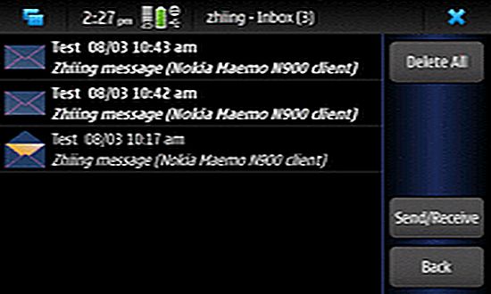 | Zhiing   Free       1 comments
Zhiing is a location messaging tool that allows you to share your location, or other locations of interest, with your friends, family or co-workers.
You can even communicate yo... |
|
|